Pakistan floods: Satellite images and maps show scale of disaster
Parts of Pakistan are currently submerged by the worst floods in the country's history.

Wednesday 31 August 2022 14:08, UK
The little boy in blue could be around nine or 10 years old. He's sat with his family on rescued furniture and they are surrounded by floodwaters.
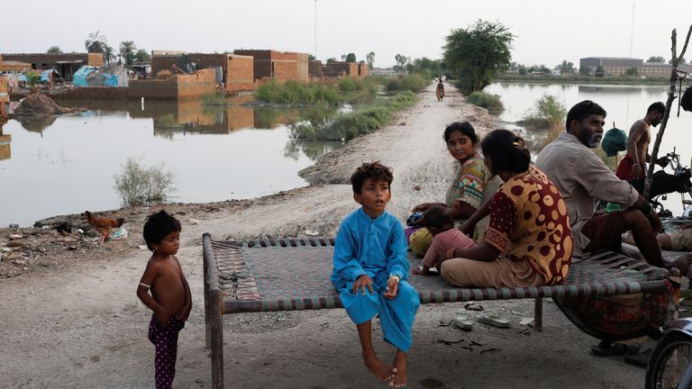
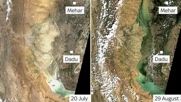
He lives in Mehar, one of the areas in Pakistan worst hit by the monsoon floods which have submerged a third of the country.
This slider shows you what the boy's home district looked like on 29 August compared to the same time a month ago.
Read More:
'Nobody cares about us': Death and despair as Pakistanis flee homes amid devastating floods
Fields surrounding the central urban area have disappeared under dark green water. Only the centre of Mehar, roads leading to it and some small parts of the landscape can still be seen.
Behind the little boy and his younger siblings, you can see a makeshift shelter made of mismatched sheets of plastic inside the damaged walls of buildings.
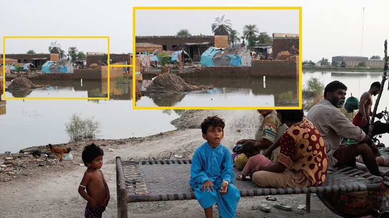
It's a sight familiar across the country.
More than 317,000 houses have been destroyed and another 734,000 partially damaged, according to the Internal Displacement Monitoring Centre.
The little boy lives in the Sindh province which has suffered some of the worst damage, according to this map made by the UN and published on 26 August.
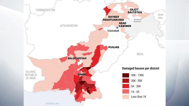
The boy in blue and his family are from an area with a population of about 460,000 people, according to the 2017 census. Mehar is part of the Dadu district, which is home to more than 1.6 million people and has been widely impacted by the floods.
In this before and after image, which shows Mehar and the city of Dadu, swathes of blue and green water can be seen flooding the Dadu district.
It is not only the Dadu district that is being overwhelmed with floodwater.
Across the country, more than 33 million people, about 15% of the population, have been affected by the flooding. More than 1,000 have died.
The red dots on this map from NASA Worldview, a satellite imagery interface, indicate where evidence of flooding over a two- or three-day period has been recorded. Issues such as cloud coverage can affect the number of dots on the map.
This map does not show all the flooded areas in Pakistan but gives us an idea of some of the worst areas.
For example, the Sindh province in the south east, has been badly hit. This highlighted area filled with red dots represents around 800 sq miles of land.
It’s home to big cities like Hyderabad, Larkana and Sukkur.
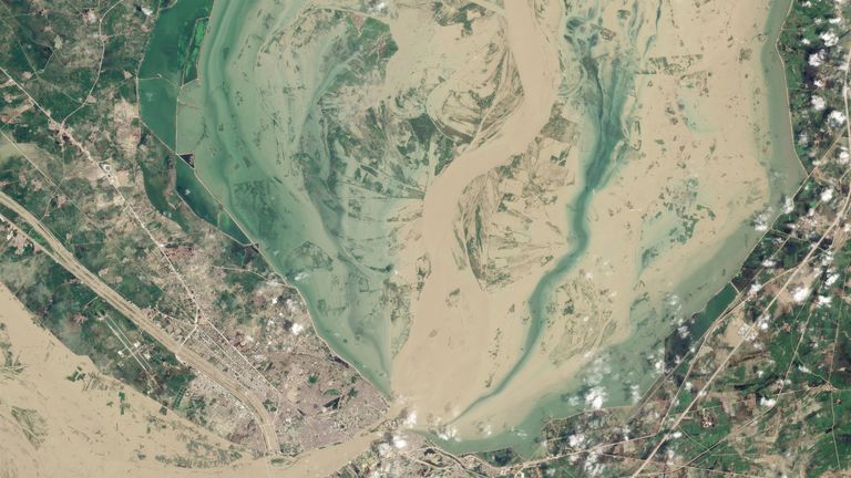
These satellite images taken by Planet Labs show brown and green water covering Sukkur in the space of a few days. 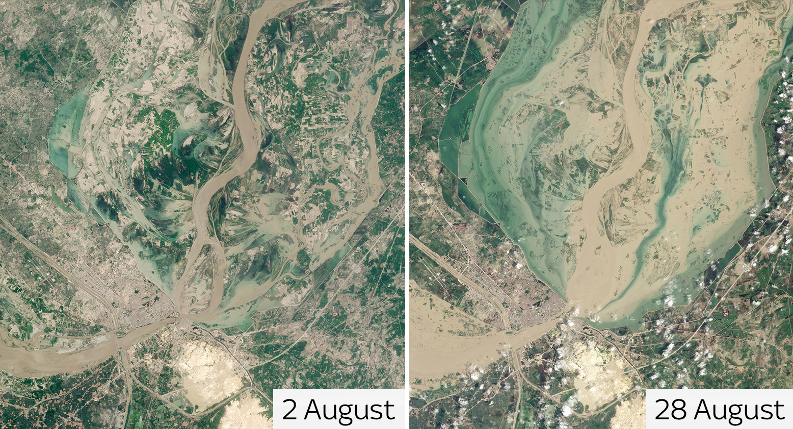
It encompasses the Dadu district, where the boy in blue lives.
Both Mehar and the city of Dadu have been overwhelmed with floods.
But heavy flooding is happening across the country, including in the north.
Large parts of Nowshera and Charsadda, near Peshawar, have been submerged by water.
This satellite image from 28 August shows Nowshera flooded with brown water from the swollen river. 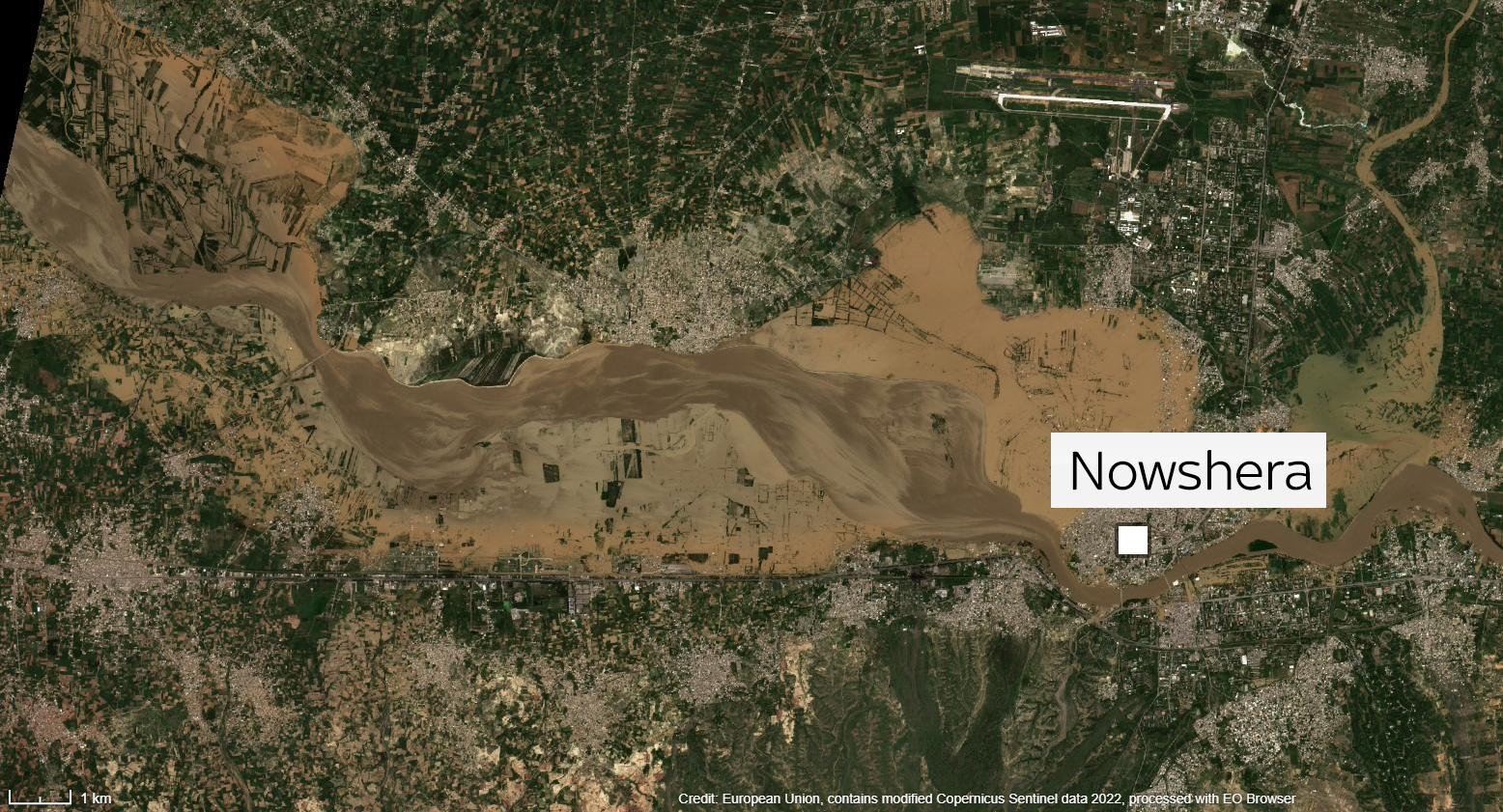
Satellite images also show heavy flooding in Gandakha to the east of the country.
As well as in Mianwali, in the north east.
Pakistan's prime minister has said the devastating floods are "probably the worst in the country's history".
The destruction has prompted the UN to appeal for $160m (£136m) in emergency funding to help the nation.
The Data and Forensics team is a multi-skilled unit dedicated to providing transparent journalism from Sky News. We gather, analyse and visualise data to tell data-driven stories. We combine traditional reporting skills with advanced analysis of satellite images, social media and other open source information. Through multimedia storytelling we aim to better explain the world while also showing how our journalism is done.